Dolomites AV 1 Trek

August 21-31st, 2026

Overview

INCLUDES

itinerary

Gallery

Overview 

Please take a few moments to watch this VIDEO from Keith and Michelle prior to booking. It highlights the most important information that we want to point out. 

Excited to have you joining us for our Dolomites AV1 Trek!!

**Please note these dates could change a bit earlier or later as we are waiting for the refuges to open. As soon as we get confirmation from our guides we will pass that information along to all.

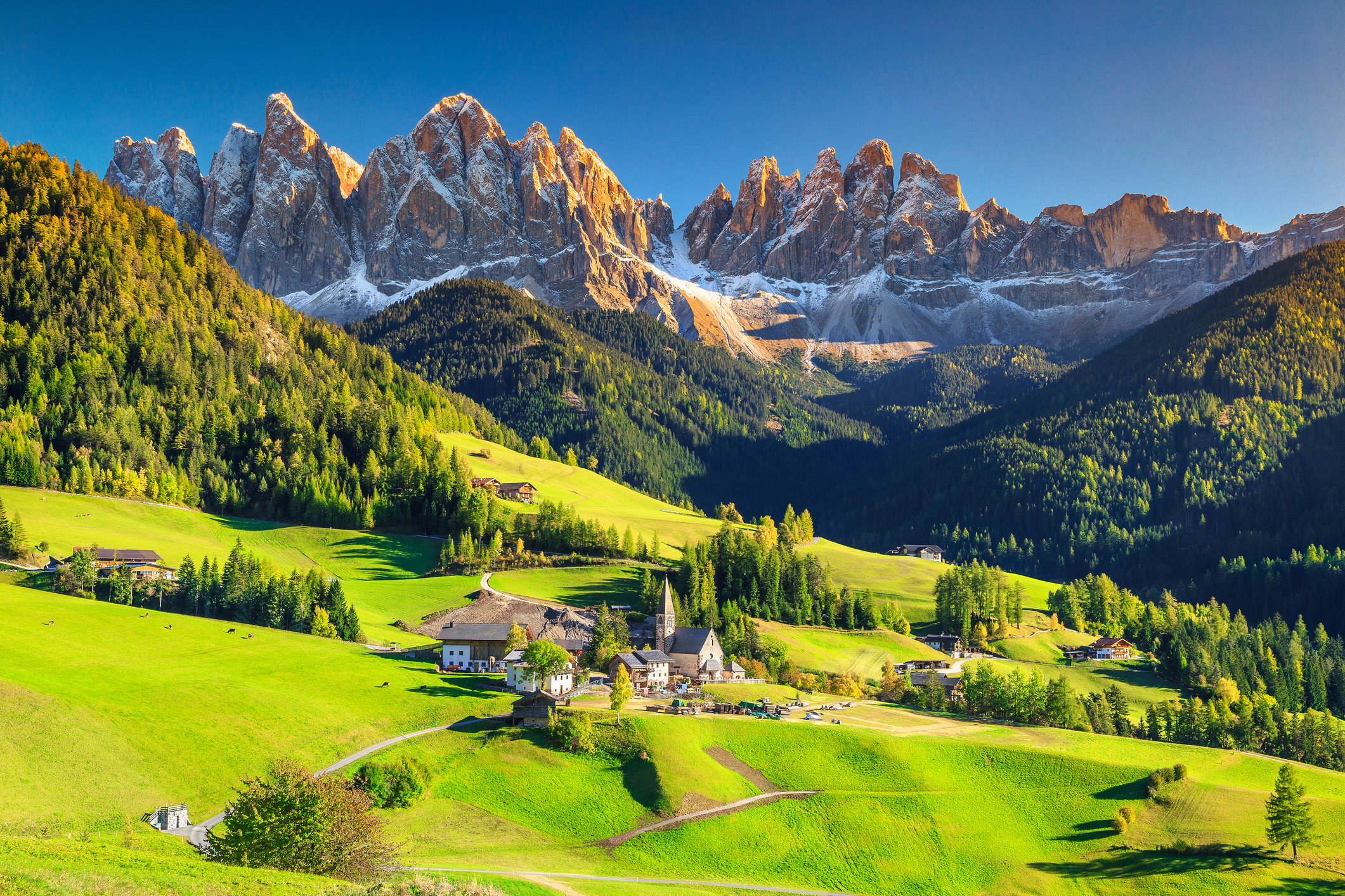
The Alta Via 1 is a walking trail through the Italian Dolomites, for 120km (75 miles) from Dobbiaco in the North to Belluno in the South.

The highest point reached on our standard route is Rifugio Lagazuoi situated at 2,752m (9,029ft). The height gain on the route is around 6,665m (21,833ft).

Trekkers typically take 9 days to complete the hike, give or take a day or two.

Some of the AV1’s most exhilarating and exacting walking comes around Passo Falzarego and the old battle sites from World War One. Optional sections with cables let the walker explore the steep rocky hillsides and tunnels, including the famous Galleria Lagazuoi.

Towards the Southern end of the route, the character changes slightly as the massifs become more distinct. The AV1 rounds Monte Civetta to its West. These latter stages are a bit more bold than the earlier ones. The general theme remains, and stage 8 across the Cime de Zita offers a full day in the open mountains.

Staying at the historic Rifugio Nuvolau is also a highlight. The hut is perched at the top of the hill (2575m) providing 360 views of the surrounding mountains making it the perfect place for both sunrise and sunset views. This is one of the most traditional huts (set up in 1883) on the trail making it more basic than some of the neighbouring huts, but it’s well worth it!

A final night is spent in an almost pastoral location yet still high in the mountains, just before Forcella la Varetta and the final roll down to the valley. Such charming spots are what make the AV1 distinct

Alta Via Uno would be the full title of the AV1, in Italian. Translated, it simply means High Route One. German is the language at the start of the AV1 and on the maps that we include in your info pack, you will see the route marked as the Dolomiten Hohenweg… again, the High Route of the Dolomites

There is great satisfaction in completing stages of a long-distance trek, even more so when it’s a famous one like the AV1. There might be times when the climb seems too much effort, and when you encounter bad weather; at such times the goal keeps you going. Equally there should be days when you feel all-powerful, tackling the mountain trails as if they were paths in the park!

One of the best feelings on trek can be nearing the end of a stage, once you’re well into the walk, knowing that you’ve ticked off another leg of the quest. At such points you’ve also got an evening in a new village to look forward to. Travelling in a self-sufficient manner through the charming yet stunning terrain of the AV1, this all makes for a thoroughly enjoyable and satisfying holiday.

Where we stay
Our Classic mix of accommodation aims to give an enticing taste of life in the Italian Dolomites and is our most popular option. We include lovely 3 or 4* hotels in Dobbiaco and Belluno plus 8 nights in cosy and welcoming Italian mountain huts. 3 of the huts we use on our trip only offer places in shared rooms or dormitories. At the other 5 huts we will try for private rooms and this would be upgraded price. (not included in current trip price).

Can I manage it?
The AV1 is manageable for fit mountain walkers who are happy to walk for between 5h and 8h per day along a long-distance trail. It will greatly help your enjoyment of the trek to arrive fit at the start, used to walks of similar distance and height gain to those that you are about to face.

One tough stage is the initial climb of 900m (2,952ft) from Lago di Braies to reach the high mountains. If the day’s optional detour to the Croda del Becco is taken, it is a day of fairly solid ascent! In other places the trail offers some particularly steep and loose paths, for example on the descent from Forcella di Lech (stage 3) as well as the ascent to Col dell Orso (stage 7), and ascent to the Cita Zima ridge (stage 8). These sections require steady balance and a head for heights.

The spacing of huts determine the distances each day, of course, and we can book many variations on our schedules according to how our clients want to approach the AV1. If you’d like a fast dash or a trip that minimises the longest days, we suggest our 8-day trek as a starting point. On the other hand, to savour the scenery on a slower schedule, we suggest our 12-day trek.

For those wary of walking the AV1 in one go, we can offer a rest day in the town of Cortina after stage 4. Cortina is a fine Italian town that comes alive in both Summer and Winter. It is a half-day’s walk or a bus ride from the AV1 route.

What’s it like underfoot?
Underfoot you will experience a variety of tracks and trails on the AV1. Standardly the mountainous sections run on single-track paths that can be rocky in places, sometimes with steps but mostly just the bare earth. Mud is not a problem in the same way as on paths in the UK, for example! Tracks are also common – perhaps gravel forest roads, ski pistes, or rough tracks for vehicles over agricultural land. There are some sections of country lanes, and on occasion some busier roads for example on the final walk to La Pissa.

Is it technically difficult?
The AV1 is first and foremost a walk. There is no glacier walking and no rock climbing. Especially of note in the Dolomites, an area famous for its via ferrata, there are no via ferrata sections on our AV1; we take the variant to La Pissa which avoids a via ferrata on the Schiara on the last day.

There are however some sections where the path crosses rocky and steep ground, plus sections with metal cables as handrails over Alpine walking terrain. Some stages cross open, unforgiving terrain without easy escape routes: full days of mountain walking calling for self-reliance especially in wet weather with bad visibility. How difficult the AV1 is for any group depends heavily on the options chosen each day. For the strongest walkers the AV1 offers variants to the main route that take in steeper and looser terrain at the upper end of the Alpine walking scale. Equally, other variants offer smoother terrain, missing harder sections. It isn’t possible to complete the AV1 on foot without at least some sections of loose ground with steep drops to the side, and the stage from Passo Duran to Pian de Fontana which is relatively exposed to the elements and high up. Please contact us and we’ll be happy to describe the difficulties in more detail. Your rouetcards contain detailed information about likely hazards on the trail.

Unseasonal weather
The typical summer’s day in the Alps brings hot sun, perhaps with occasional rain or afternoon storms. Fresh snowfall can occur each summer, most often, these leave a coating of an inch or two on higher passes only, and they disappear in a day or two. However, sometimes the snow stays for longer periods and is deeper. While the AV1 should be approached as a summer Alpine trek, with snow quite unlikely, it is wise to know that snow can fall even in summer.

Includes

  • Accommodations in itinerary
  • Transportation listed in itinerary
  • Meals indicated

Not Included

  • Transportation not listed in itinerary
  • Accommodations not listed in itinerary
  • Meals not listed
  • Alcoholic drinks
  • Tips - any tips you would like to contribute to our guides

Trip Outline Itinerary

\
Arrival Day - Aug. 21

Arrival day: Arrive in Dobbiaco

Your trips starts on arrival in Dobbiaco. This decorative town is in the Sud Tirol style and is on the branch railway line from the Brenner pass. There are several restaurants for dining out.

Hotel in Dobbiaco

\
Aug 22

Stage 1: Lago di Braies to Rifugio Sennes

(grade) 9.4km with 920m ascent, 300m descent

Take the bus to Lago di Braies, and then the mountains start immediately above this glacial lake hemmed in by mountains. The local bus takes you there from Dobbiaco. Take to the hillside, steep and loose in places, and climb towards Croda de Becco, an optional 2,810m peak that is a detour on the way to your hut. Views of the limestone peaks open up as the route climbs higher. (We also describe the pleasant cross-country walk to Lago di Braies, an addition for those wanting a fuller day.)

Mountain hut 

\
Aug 23

Stage 2: Rifugio Sennes to Rifugio Lavarella

(grade) 10.1km with 530m ascent, 570m descent

Cross-country is the theme for the next two stages as you cross large areas of upland meadow and rock. Cut across grassy meadows from Rif Sennes before descending in steep hairpins to Rif Pederu. Follow a track up from the road to Rif Lavarella and the surrounding huts.

Mountain hut (dinner and breakfast)

\
Aug 24

Stage 3: Rifugio Lavarella to Rifugio Lagazuoi

Red 3 (grade) 14.8km with 1,325m ascent, 630m descent

From Rifugio Lavarella take the track up to a high plateau where we have 2 options for the day. Our main route continues through the high valley to reach Capanna Alpina. From there we climb gradually to reach Le de Lagacio. Our harder route reaches Le de Lagacio over the steep Forcella di Lech. From the lake, climb steeply to reach Rifugio Lagazuoi, the highest hut on the trip at 2,752m. From the hut it’s worth making the short climb to the summit of Lagazuoi.

Mountain hut

\
Aug 25

Stage 4: Rifugio Lagazuoi to Rifugio Nuvolau

Purple 2 (grade) 9.9km with 710m ascent, 860m descent

Today there is the option to explore the Galleria Lagazuoi, a restored First World War tunnel. The main walk takes you to under the shadow of the immense cliffs of the Tofana de Rozes, before heading into the valley. The climb back into the hills near the splendid Cinque Torri (five towers) and onto the bold ridge that holds the Nuvolau hut. This small and simple hut is one the most atmospheric on the AV1. Nearby Rifugio Averau is our comfy alternative, and offers some of the best food on the route.

Mountain hut (dinner and breakfast)

\
Aug 26

Stage 5: Rifugio Nuvolau to Rif Citta’ di Fiume

Purple 2 (grade) 13.4km with 390m ascent, 1,040m descent

Retrace your steps down the ridge and skirt underneath it to reach Passo Giau, second of the road passes above Cortina. The hills beyond allow wide open walking over meadows, interspersed with short climbs. At the end of the day, the realm of Cortina is far behind and the Zoldo area looms large. Monte Pelmo is unmistakeable in view with its two summits.

Mountain hut

\
Aug 27

Stage 6: Rif Citta’ di Fiume to Rifugio Vazzoler 

(grade) 18.2km with 750m ascent, 950m descent

Passo Staulanza is crossed early today, being a wooded road pass.

After Rifugio Coldai we pick up a long traverse around the back of Monte Civetta. We walk in and out of rocky hollows, the Civetta always on our left. Rolling downhill at the end of the day we come to Rifugio Vazzoler in its wooded setting.

Mountain hut

\
Aug 28

Stage 7: Rifugio Vazzoler to Passo Duran

(grade) 11.5km with 650m ascent, 760m descent

Today’s distance passes quickly on generally good terrain, with short sections of more slow-going and steep walking, and a couple of rocky steps in exciting positions. Several combes are crossed as we round the Southern end of the Civetta massif. Reach the quiet road at Passo Duran and our welcoming hut, with its characteristically Italian menu.

Mountain hut (dinner and breakfast)

\
Aug 29

Stage 8: Passo Duran to Rifugio Pian de Fontana

Purple 4 (grade) 16.7km with 1,085m ascent, 1,050m descent

Enter an area of bold mountains today, at times with a more remote feel than the hills before. The crossing of the Cime di Zita involves a narrow ridge, at the higher end of difficulty for the AV1. Just before the main climb, Rifugio Sommariva makes a good stopping point for lunch. Descend a long, steep and interesting hillside bringing you to a grassy shelf hidden from civilisation. Here sits the Pian de Fontana refuge, a rustic and charming place to spend the night. (This is our second quite basic hut, with dorms and with one cold shower, but the atmosphere is so cosy.)

Mountain hut

\
Aug 30

Stage 9: Rifugio Pian de Fontana to La Pissa

(grade) 12.2km with 250m ascent, 1,440m descent

The trek ends with a modest half-day stage to the road. To avoid the AV1’s via ferrata finish over the Schiara massif we take the straightforward path to Rif Bianchet, then the wide track to La Pissa.

We catch the local bus to Belluno. The city comes as a contrast to the calm of the trek, being a lively place very much in an Italian style. We suggest a lively, informal restaurant in the middle of town.

Hotel in Belluno (breakfast)

\
Aug 30

Departure day: Depart from Belluno

Enjoy your last breakfast in Belluno and look round the old towns before departing. The train to Venice makes it easy to keep exploring and we can advise on further travel in Italy.

Travel insurance

Travel insurance is designed to help cover your expenses if something goes wrong on your trip, and fill any gaps that wouldn’t be covered by your primary health insurance or other insurance you may have. It’s not meant to be a substitute for health insurance and won’t cover non-essential overseas medical treatment, such as routine exams.

Travel Insurance by InsureMyTrip

Address

MORE Adventures

1627 W. Main 257
Bozeman MT 59715
United States